
Back to the Forest
Hair’s Breadth | Wellsprings | The Last Saxon | Of Old Growth and Evil Wax | Hagas | Beyond the Pale | Field-shadows
There is a hill west of the footpath, the last slope of the ridgeway before it banks into a three-way crossroads. The hilltop is crowned with oak and from it are long-range views to the south. The edge that peters into tarmac is wrinkled: plough-furrowed, or something else? On the hill’s flank in certain conditions, at certain times of year, outlines appear in the grass. Shapes, shadows of shapes, in the cow-pasture. What does the land remember here, that we have forgotten? A settlement? Is the wrinkled hill the parish barrow; do the dead lie under the hill-bank, their once grand monument weathered and timeworn out of plain sight? Sometimes that’s all that’s left of the past: shadows in the fields, shapes beneath the oaks.

Duffield Frith—a private, then royal, hunting forest—occupied a large area of mid-Derbyshire for around 600 years. Yet the majority of folk living there now have no inkling of the forest’s existence. That on their dog walks and evening strolls with a single footstep they might, but for the passage of years, be crossing from land bound by common law into forest law, or passing within a hair’s breadth of an old charcoal burner’s hut, or walking in the autumn woods beside a vanished pig-drover taking advantage of the windblown nut and mast. Pilgrims, parkers, palers, monks, lords, ladies, smiths, wrights, knights, millers, minstrels, foresters, friars and kings, they all passed through the Old Frith once.
The Frith has been won by conquest, confiscated from rebels, afforested by royalty and finally disafforested in 1633. It has been quarried, farmed, felled, fenced, hunted and harried. Its once-important boundary historians have been able to map, as well as its four wards and seven parks. Significant landmarks were (and are) used as boundaries, including the Frith’s three rivers, the Ecclesbourne, the Amber and the Derwent, its lesser streams and old roads. It was paramount that locals knew where the boundaries lay so that they could keep their noses clean and heed (or appear to) the differing laws on either side of the dividing lines. Some forest boundaries abide, but today they mark the bounds of other things, like fields or parishes. The Old Frith now is encircled only by ghost boundaries, crossed unwittingly by 21st century walkers and motorists, their significance long since passed from mind and memory.
But time too is a borderline, a boundary that can be forded, thin and frayed in places. Rivers and roads are hard boundaries, undeniable and sometimes hard to cross. Temporal boundaries are less easily-defined, more permeable. The author Susan Cooper described these islands as ‘soaked in their centuries’ - Britain as a sponge fat and heavy with the long marination in its ages. Cooper’s novels are concerned with history, she plays with time and her characters frequently cross thresholds into the past. Walking, in quite a different way, allows the crossing of time’s thresholds. To look a little deeper and absorb oneself in the history of a place transforms it, revealing those things hidden in the landscape that carry the past to us, or us to it. To have a sense for and perceive a place’s history thins time’s barrier. There are many roads to the past hereabout. They can be sought in the extensive written archives for the old forest that record years of human endeavour - bills, receipts, wood surveys, land contracts, court proceedings and fines - all testament to how the forest was used and what was taken from it, what its parts cost to buy and sell. They are in the land that archives its own history, coded into field shapes, place-names, laneways and other features, some visible only to those who have an eye for the open secrets of landscape. Even the forest’s people linger, their riots and petty crimes recorded, their pleading petitions to monarchs documented, their stone walls standing, their labour evident in the outgrown coppice of old woods. My time-machine, my fords to the past, are made from these breadcrumb trails. From court rolls, hollow trees, local histories, drystone walls, archaeological papers, lichen-scaled rocks, old roads, rivers and field-tumps. These are wellsprings of the soaking centuries, visitations by the past, seeping up around our feet.
One of these wellsprings was created by a small number of chroniclers working in the Frith around 1080. They were the commissioners who would help create the Domesday Book, agents of William I sent to survey the shires of his newly conquered realm. In this great record of England many of the Frith’s settlements, dutifully transcribed, are extant today. The surveyors and scribes recorded the names of the Saxon landowners before the conquest, and in Duffield they scratched out the name Sigeweard Bearn. Sigweard Bearn was an Anglo-Saxon thegn, warrior, landowner and an earl of Mercia who held sake and soke of Nottinghamshire and Derbyshire, meaning that he had full jurisdiction within the two shires. He owned much of what became Duffield Frith, residing (most likely) in a great wooden hall in Duffield at the site of the former castle.1
Dispossessed from his lands, not willing to accept Norman rule, Sigeweard rebelled against his new king. He was present at the last stand of the Anglo-Saxons at Ely in Cambridgeshire in 1071, alongside a band of other rebels including Æthelwine, Bishop of Durham, Earl Morcar of Northumbria as well as the now almost Robin Hood-like figure of Hereward the Wake. Here Sigeweard fought, lost, was captured and carted off for imprisonment.2 Sigeweard looms large in my imagination, the last Saxon lord of these lands. The tapestries of our lives are set upon the same loom; we share space, divided only by time. When I am walking along the old ways of the Old Frith—the old turnpike road to Duffield with its long views south, or the long-backed and ancient Chevin ridgeway that humps over the Derwent Valley like a sleeping dragon—I wonder, did Sigeweard occupy this space too? If a window were to open to the past, would he be stood where I am now, shielding his eyes and looking upon the hills of Windley and Turnditch? Or following field-paths down to the banks of the Derwent? Is the blackbird in my ear a descendant of the blackbird that was in his?
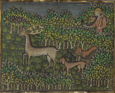
If we have shared a view, Sigeweard and I, the 900-odd years that divide us lie heavy on the land. While I look upon patchwork fields, little copses, tarmac, sprawling towns, villages and industrial parks, the land he knew was chiefly woodland pasture (excellent hunting terrain). The Domesday Book tells us Duffield had woodland cover four leagues long and two wide. A league is 1.5 miles according to the glossary on the Open Domesday website, which gives us six miles of woodland, quite extensive by today’s standards. Sigeweard’s woods would have been less tame than ours. Wolves and boar roamed free in them and outlaws used their quiet corners to lie low in later centuries. In these woods were great old trees, the sort one sees only rarely today, described in Duffield Frith’s surveys as being of old growth and evil wax. Chances are that into these wild woods rode Sigeweard Barn. In popular imagination deer hunting is associated with the Middle Ages, with fur-clad medieval kings skewering boars amid sycophantic cheering. But it is now widely held by historians that high-status Anglo-Saxons, like their European counterparts, were also great huntsman and concerned themselves with managing and hunting deer and the other so-called beasts of the chase. Della Hooke, an historical geographer specialising in landscape history and Anglo-Saxon England, analysed Pre-Conquest charters and found them to contain words that document the land’s use for deer management:3
haga - (Old English) - has its root in ‘hedge’ and from the eleventh century associated specifically with deer enclosures or boundaries related to herding deer.
haia - haga's Latin equivalent
derhage - (Old English) - deerhay, deer enclosure.
The jagged edges of haga serve it well as word of boundary, of restricted passage, a spear-thrust of a word that reflects its shared roots with hawthorn.
William the Conquerer threw up hagas, thorny boundaries between the new England and the old. His infamous Harrying of the North is a testament to how ruthless he was to those who didn’t willingly cross over to his side. While the Saxon lords were dispossessed, William handed England’s parts out to his cronies like sweets. Sigeweard’s lands, the Old Frith, were awarded to Henry de Ferrers (who was possibly present at the Battle of Hastings) and it stayed in this family for several hundred years, until one of Henry’s descendants rebelled against his king, and the lands were confiscated.
Over the sea with the Conquerer, his army and his new regime came the European concept of royal forests. ‘Forest’ was a legal term rather than a topographical one, and areas appointed as royal forest were bound by laws and customs that differed to the general laws of the land. Much of England’s woodland, woodland pasture and moorland was subjugated into forest. Whilst Anglo-Saxons had previously been free to hunt on their own land, post-conquest forests were owned by the king and the killing of deer and boar was forbidden except by a chosen few.
Forests were first and foremost preservations of venison and vert - deer and the greenery that sustained them. The lands surrounding Duffield became the Ferrers’ private hunting grounds and throughout the following centuries in this half-wild land the great, the good and the less so got their sport by hunting hart, hind, boar and hare. John of Gaunt rode in the Frith, so did Kings Edward I, Edward III and Henry IV. The hunting of deer was the reserve of nobleman only and was not only a highly fashionable part of their culture, but an important character-building one. Forays into the forest for deer were also quests for morality, fitness and status. Lands were held in exchange for military service and men such as Henry de Ferrers were bound to go into battle with a given number of armed men should the king call upon them. They needed to be physically and mentally ready for this and hunting kept them fit as warriors by improving both their stamina and their stomach for danger. Hunting was seen as an antidote to sensuality: along with their quarry, noblemen were slaying the softness in themselves.
Beneath the romantic image of forests, of knights and chivalry, running deer and thick woods, is hard toil, rules and regulations. The everyday people of the forest had to make a living and regardless of whether you were near the top or the bottom of the feudal pyramid, forest-dwellers had restricted use of wood, timber and turf as well as agricultural land - manorial lords and commoners alike. This is handy for historians because the application of forest law and the paperwork it produced has left a vast legacy of documentary evidence. One of the first written records of Duffield Frith comes from the chartulary of the religious house of Darley Abbey in 1154-8, a detail of the canons’ right to take a cartload of timber from his wood at Duffield and Chaddesdon, granted by Henry’s great-grandson William de Ferrers I. William granted Darley Abbey licence to take wood through Duffield Frith by water [the River Derwent] twice each year for a period of three days.4
There is a footpath I walk along occasionally on a particularly dismal stretch of the Derwent, opposite an industrial park and next to a sewage plant that regularly befouls the river. Yet in summer there is still something about this place that the shoddiness of the 21st century can’t quite steal away. Beyond the dense green foliage, brown and slow as a snake the Derwent flows as it has done for vast ages. Where a goosander serenely sails now, once, creaking and low in the water, the heavily-laden rafts carrying wood for the monastery steered through Belper, Duffield, Allestree and into Darley Abbey. But the river is much changed. No ferryman now could navigate the weirs built by the Strutt family in the 18th and 19th centuries, corralling the river’s power for their cotton mills. At night, when the busy A6 that accompanies much of the Derwent quietens, the sound of the weirs’ torrents fill up the valley, drowning out its ghosts.
The forest was divided into wards and inside these wards were designated parks, and they had the strictest rules. Medieval aristocrats liked a good feast and deer parks were the living larders that kept a steady supply of venison flowing to the plates of the nobility. The deer were enclosed in the parks by pale—ditch, bank and fence—which was of such importance that several people were employed to maintain it. Parkers made daily perambulations of their parks and ‘not infrequently had under them palers, palesters, or palifers, who were permanently employed to maintain the pale fences of the parks.’5 The significance of securing these boundaries has an afterlife in our language; if I am beyond the pale, then my actions are unacceptable.
Centuries after the Frith was disafforested (stripped of forest status) park boundaries are still present in the landscape, bumps and banks that haven’t succumbed to building or the plough. They abide too in place names, medieval spectres charted onto the neat grids and colour codes of modern Ordnance Survey maps. I can walk today down Palerow Lane and Palace Lane, pass Palefence Farm, their names badges of the histories and centuries they have borne. Keepers of old tales, these words, ineffectual parkers failing to make fast the fences between the past and the present. Of all the miscellaneous rubble left by history I find place-names the most fascinating to sift through, and there are plenty left behind from the forest days. I can pass under the pleasant beech eaves of Swinney Wood, an old place of pannage. I can walk down Cowers Lane, passing the location of the forest’s vanished cow house, and over to Shottlegate - le Parke yate de Shothulle - which remembers an old way into one of the deer parks.
To many local folk the features, fragments and place-names that remember the forest mean nothing; the Old Frith’s borders they cross unwittingly, the imaginative ones not at all. But there’s fertile ground beneath the old oaks, in the fields where the shadows are. Time wavers here. The occupations and preoccupations of long-gone people, they occupy and preoccupy me. They carry me backwards, the direction in which I long to travel. Out walking in the lanes, woods, fields, villages and towns of the Old Frith I stand at the confluence of two streams - I tread the intersection where imagination meets history. Here, knights in green come crashing through the trees, monks in dark habits count their tithes of timber as they come floating down the Derwent and a mighty Saxon lord, dismayed with his new king, plots treason by candlelight.
Duffield Frith: History and Evolution of the Landscape of a Medieval Derbyshire Hunting Forest by Mary Wiltshire, Sue Woore, Barry Crisp and Brian Rich
Sigeweard Bearn was eventually released as old King William lay on his death bed, humbled by his imminent appointment with his maker.
‘Pre-Conquest Woodland: its Distribution and Usage’, by Della Hooke, Agricultural History Review, Vol 37 No 2, accessed online: https://www.bahs.org.uk/AGHR/ARTICLES/37n2a1.pdf
Duffield Frith by Mary Wiltshire et al.
The Royal Forests of England by J. C. Cox